
About the governorate
Information and history of the governorate
Brief Profile of Damietta

History testifies that Damietta was Egypt's primary gateway to the Mediterranean coast, making it a constant target for foreign invasions seeking to occupy it, and resulting in a rich history of battles and events.
God blessed it with a unique location, enchanting nature, and a pleasant, temperate climate year-round. This has significantly influenced the character of the people of Damietta, fostering a spirit of work, activity, and dynamism. The Damietta Governorate enjoys a range of comparative advantages and competitive strengths that distinguish it from other governorates in the Republic. Economic activity in Damietta is considered among the best models for development, achieving rapid economic growth based on fundamental pillars, namely:
Send feedback
New Damietta City has recently become one of the most vibrant coastal areas, with services concentrated in its various neighborhoods and districts; among the most important of these districts
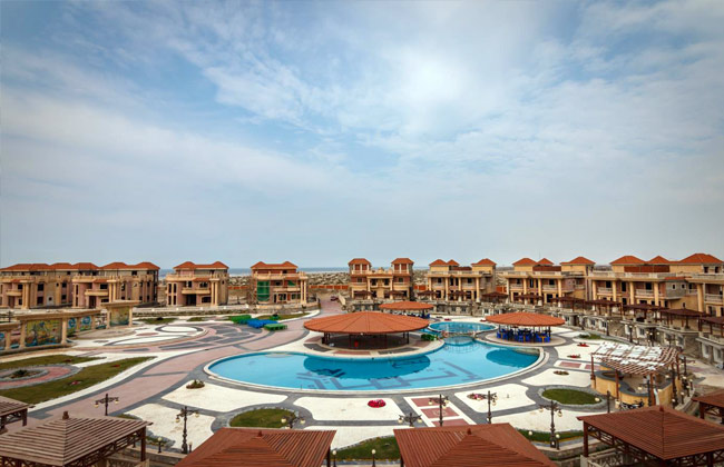
New Damietta City is filled with numerous compounds catering to various budgets. Some are located directly on the sea, while others are situated in the heart of the city. Among the most prominent of these compounds are: Ithmar New Damietta Village Beit Watan (Damietta Park Area) Lusail Compound Jannah (Distinguished Sixth District) Dar Misr Project
Apartment prices in New Damietta range from 300,000 Egyptian pounds to 1.5 million Egyptian pounds. Land prices in New Damietta start at approximately 5,000 Egyptian pounds per square meter.

The Urban Communities Authority has offered plots of land in New Damietta, to be sold through an immediate allocation mechanism in April.
Lusail Park has vast green spaces

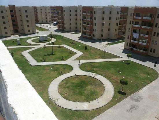
The construction of (31) residential buildings in the Tel El-Deir area, south of the First District, is underway as part of the “Housing for All Egyptians” project (Middle Income Axis). These fully finished units feature modern designs, fulfilling the needs of citizens seeking suitable housing in New Damietta City.
Location
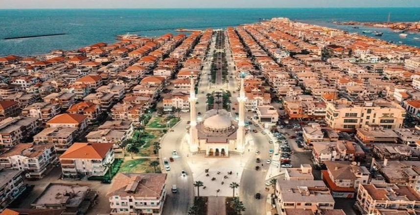
The location of New Damietta is one of its most important features, as it overlooks the Mediterranean coast north of the current Damietta Governorate, and is about 4.5 km away from Damietta Port. The city can also be easily reached via the international coastal road that connects the Arab East and West, passing through Sinai.
Total Area
Total Area
The area of New Damietta City is 12,798.31 acres, and it extends for 9 kilometers along the Mediterranean coast.
Population
A population of 1,654,604 inhabitants
Major Districts and Streets in New Damietta
New Damietta has recently become one of the most vibrant coastal areas, with services concentrated in its various neighborhoods and districts. Among the most important of these are:
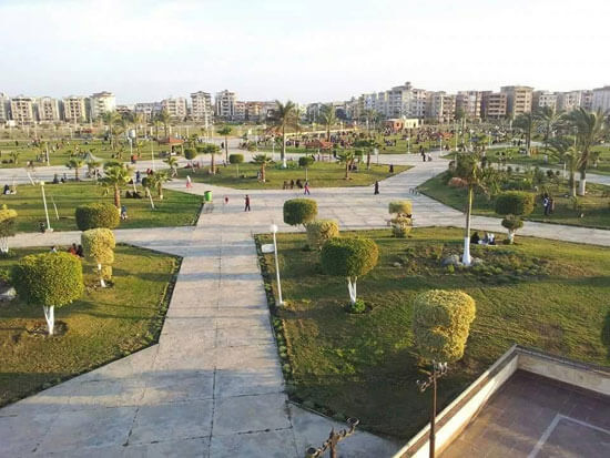
The Central District, which houses the New Damietta City Authority, hospitals, the stadium, the electricity company, the central park, and other essential services.
District 1, which includes schools, shopping centers, and Al-Azhar Hospital.
District 2, which includes colleges, clubs, and universities.
District 3, which consists largely of residential areas.
District 4, which contains numerous schools.
District 5, which offers upscale housing.
The Industrial Zone in the southeast of the city, which includes approximately 600 factories.
A beachfront chalet area.
Hasaballah El-Kafrawy Street, also known as El-Saidi Street.
Mubarak El-Sab'een Street.
Send feedback
Press tab for actions